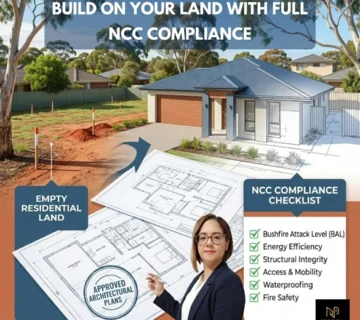
A property blueprint into a successful development application is a crucial process in the world of real estate and construction. The blueprint, which lays out the foundation of your proposed project, is more than just a technical drawing—it is the blueprint of your vision for a property. However, simply having a blueprint is not enough. To transform that vision into reality, there are several essential steps that must be followed to ensure a smooth application process, from sourcing accurate blueprints to submitting all the necessary documents and plans to the planning authorities.
In this guide, we’ll walk through the entire journey, beginning with obtaining the correct blueprint and moving through survey planning, architectural designs, material selections, documentation, and application preparation. Each of these steps plays a key role in ensuring that your development not only complies with legal regulations but also meets sustainability standards and local council requirements. By following these well-structured steps, you’ll be on the path to achieving a successful application that can bring your property development project to life.
Source the Blueprint of a Property
A property blueprint is a detailed architectural plan that outlines the layout, dimensions, and boundaries of the land and any existing structures. It forms the foundation upon which all future plans are built, ensuring that the project complies with local zoning laws and building regulations. To source the blueprint, you can obtain it from reliable sources such as property records, local councils, or professional databases. Additionally, working with property professionals or licensed surveyors can help ensure that the blueprint is accurate and up-to-date.
Understanding the Importance of a Property Blueprint
A property blueprint is a critical document that serves as the foundation for any real estate development project. It provides a detailed representation of the property’s layout, including its dimensions, boundaries, and any existing structures. This blueprint is essential for several reasons. First, it ensures compliance with local zoning laws and building regulations, helping to avoid legal issues that can arise from misinterpretation or errors in property boundaries. Second, it facilitates effective communication among stakeholders, including architects, engineers, and contractors, by providing a clear visual guide that outlines the project’s scope and design.
Verify the Accuracy of a Blueprint
The accuracy of a blueprint is a vital step in the property development process, as even minor discrepancies can lead to significant complications later on. An accurate blueprint reflects the property’s true dimensions, boundaries, and features, which is essential for compliance with zoning laws and building regulations. To ensure accuracy, it is important to cross-reference the blueprint with official property records and survey data.
Use Digital Tools and Platforms for Blueprint Access
In today’s digital age, accessing property blueprints has become more efficient thanks to a variety of online tools and platforms. Many local governments and municipalities now provide digital access to property records through their websites, allowing users to search for and view blueprints from the comfort of their homes. These platforms often include interactive maps and databases that display zoning information, property boundaries, and other essential details. Additionally, specialized software and applications designed for architects and developers can streamline the process of creating, sharing, and modifying blueprints.
How Blueprint Accuracy Impacts Project Success
The accuracy of a blueprint plays a crucial role in the overall success of a property development project. An accurate blueprint ensures that all dimensions, boundaries, and structural elements are correctly represented, which is essential for compliance with local regulations and zoning laws. When the blueprint is precise, it minimizes the risk of costly errors during construction, such as miscalculations that can lead to structural issues or code violations. Moreover, accurate blueprints facilitate effective communication among architects, engineers, and contractors, helping to ensure that everyone is on the same page regarding the project’s vision and requirements.
Engage with the Surveyor for Survey Plans

A licensed surveyor to create accurate survey plans is a critical step in any property development project. Surveyors provide precise measurements of the land, including its boundaries, topography, and existing structures, which are essential for ensuring that the property complies with zoning laws and regulations. The surveyor’s expertise is invaluable for identifying any potential issues, such as boundary disputes, encroachments, or easements, that could affect the development. These survey plans form the foundation for architectural designs, engineering work, and legal documentation, making them a key part of the planning and approval process.
Why Engage a Surveyor for Accurate Survey Plans?
A surveyor for accurate survey plans is essential for any successful property development. A surveyor provides precise measurements of the land, including its boundaries, topography, and any existing structures. These measurements form the foundation for creating a reliable Blueprint of Property, ensuring that the design aligns with the actual physical characteristics of the site.
Role of a Surveyor in Blueprint Creation
A surveyor plays a crucial role in the creation of an accurate Blueprint of Property, which is the cornerstone of any development project. Their expertise lies in measuring and mapping the physical features of the property, including boundaries, elevations, and existing structures. These detailed measurements ensure that the Blueprint of Property accurately reflects the land’s true layout, helping developers, architects, and engineers design plans that fit the site perfectly.
Resolve Boundary Discrepancies with Survey Plans
Boundary discrepancies can pose significant challenges during property development, but survey plans provide the solution. Accurate survey plans, created by professional surveyors, help resolve conflicts related to property boundaries by offering precise measurements and legal documentation. These plans clarify the exact limits of the property, which is essential for creating an accurate Blueprint of Property. When there are disputes or uncertainties regarding boundaries with neighboring properties, the survey data serves as an official record to verify the correct property lines.
Using Survey Plans to Support Property Development Applications
Survey plans are an essential tool for supporting property development applications, as they provide accurate and detailed information about the property’s boundaries, topography, and features. These plans form the foundation of a comprehensive Blueprint of Property, ensuring that the proposed development complies with local zoning laws and building regulations. When submitting an application to planning authorities, an accurate survey plan demonstrates that the development is based on verified data, reducing the risk of errors or objections.
Prepare a Set of Architectural Plans Based on the Blueprint of Property

A set of architectural plans based on the Blueprint of Property is crucial for translating the land’s measurements and layout into a workable design for construction. The Blueprint of Property provides the foundation, outlining the precise boundaries, topography, and existing features of the land. Architects use this information to design structures that fit the property’s specifications while adhering to local building codes and regulations. The architectural plans include detailed layouts of the building’s interior and exterior, ensuring the design aligns with the site’s physical characteristics
Prepare a Material and Finishes Plan Aligned with the Blueprint of Property
Preparing a material and finishes plan aligned with the Blueprint of Property is a vital step in ensuring that the construction materials and design elements are compatible with the property’s layout and requirements. The Blueprint of Property provides key details such as structural dimensions, environmental conditions, and zoning regulations, all of which influence the selection of materials. For example, materials need to be chosen based on factors like climate, site location, and design specifications to ensure durability and compliance with local building codes.
Prepare BASIX for the Proposed Development
A BASIX (Building Sustainability Index) certificate is a key requirement for ensuring that a proposed development meets sustainability standards in areas such as water usage, energy efficiency, and thermal comfort. The BASIX assessment is mandatory in certain regions, particularly in Australia, for residential developments. It ensures that new constructions are designed with environmental sustainability in mind, reducing greenhouse gas emissions and promoting efficient use of resources.
Gather All the Plans and Documentation Related to the Blueprint of Property
The plans and documentation related to the Blueprint of Property is a critical step in the property development process. This involves compiling all necessary documents, including architectural plans, engineering reports, survey plans, BASIX certifications, and any relevant permits or approvals. By organizing these materials, developers ensure that the Blueprint of Property is fully supported by comprehensive documentation that reflects the project’s design, compliance, and sustainability goals. This thorough collection of information is essential when submitting applications to local councils or planning authorities, as it demonstrates a clear, well-considered approach to the development.
Prepare Application for the Proposed Development Based on the Blueprint of Property
This blueprint serves as the foundation for the application, providing essential details about the property’s layout, dimensions, and existing conditions. When submitting the application, it is important to include comprehensive documentation that aligns with the information in the Blueprint of Property. This may include architectural plans, survey data, and any relevant environmental assessments. A well-prepared application not only outlines the intended development but also demonstrates compliance with local zoning laws and building regulations.
Request Documentation for the Council Based on the Blueprint of Property

This blueprint provides crucial details about the property’s layout, boundaries, and intended use, which are necessary for obtaining the required approvals and permits. When submitting a request to the council, developers need to include all relevant plans and documents that align with the Blueprint of Property, such as architectural designs, engineering reports, and environmental assessments. This ensures that the council has a comprehensive understanding of the proposed development and can assess its compliance with local regulations and zoning laws. By thoroughly preparing and aligning the documentation with the Blueprint of Property, developers can streamline the approval process and minimize the risk of delays or complications in moving forward with their project.
Submit All Plans and Documentation to the Planning Portal
Submit all plans and documentation to the planning portal is a critical final step in the property development process. This involves uploading comprehensive and organized files, including the Blueprint of Property, architectural plans, engineering reports, survey data, and any other required documents. The planning portal serves as a centralized platform for local authorities to review and assess development applications, making it essential to ensure that all submissions are complete and accurate. Properly organizing these documents not only facilitates a smoother review process but also demonstrates professionalism and diligence on the developer’s part.
Conclusion
The Blueprint of Property serves as the foundation for every step, ensuring that all subsequent plans and submissions are grounded in precise measurements and legal requirements. By engaging qualified professionals, such as surveyors and architects, developers can create comprehensive and compliant architectural plans that reflect the vision for the project. Furthermore, gathering all necessary documentation and submitting it through the appropriate channels, such as the planning portal, enhances the chances of approval from local authorities.
Each phase, from preparing the material and finishing plan to requesting documentation for the council, plays a critical role in demonstrating due diligence and commitment to regulatory standards. In conclusion, a well-structured application based on a solid blueprint not only streamlines the approval process but also lays the groundwork for a successful and sustainable property development By prioritizing accuracy, compliance, and thoroughness, developers can navigate the complexities of the planning process and bring their vision to life. For assistance or inquiries, you can reach us at +1493 128 930.


